St Helens Country Cottages
- St Helens Country Cottages
St Helens Country Cottages (Clare,Австралия)
     |
| Категория отеля: | |
| Адрес: | 72 Warenda Road, 5453 Clare, Австралия |
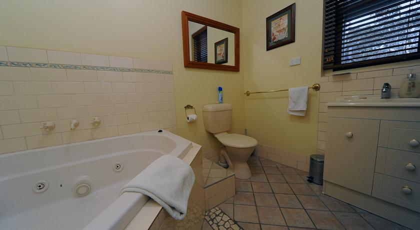
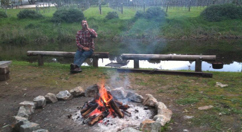
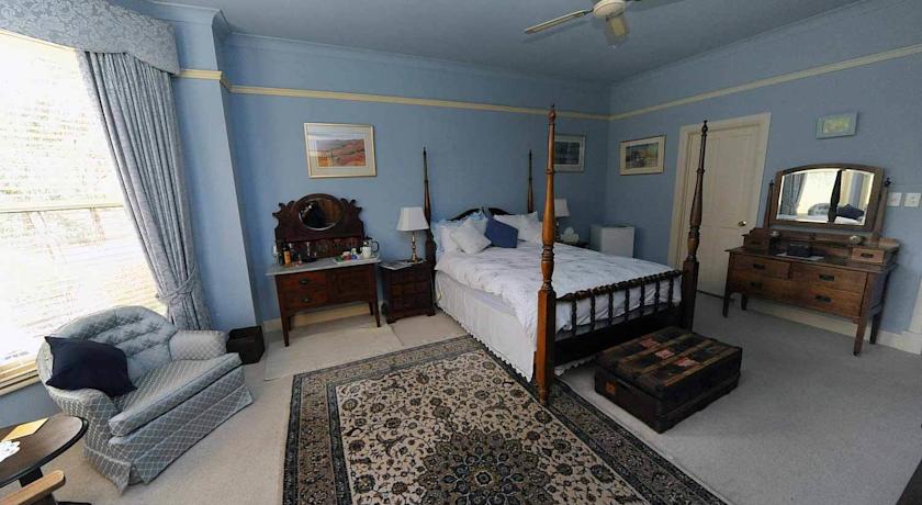
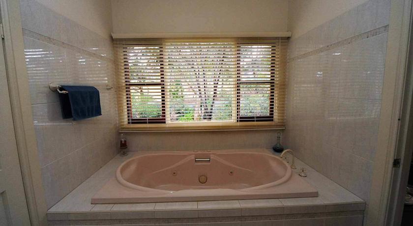
| Описание: | Boasting self-contained accommodation with a patio, fireplace and spa bath, St Helens Country Cottages is located in Clare. Guests enjoy free on-site parking and free Wi-Fi in public areas.Being located in the Clare Valley wine region, St Helens Cottages are within minutes of several vineyards including Tim Adams Wines, Pinks Reserve and Knappstein Wines.All air-conditioned cottages and suites feature either a fully equipped kitchen or a kitchenette. Each has a lounge area with a sofa, DVD player and flat-screen TV. All include country-style furnishings and décor. Some accommodation includes a four-poster bed.Guests can relax in the lovely gardens, or play a game of Petanque bowls. There are also walking and cycling trails directly accessible from the property. |
| Еда и питье: | |
| На свежем воздухе: | Сад |
| Парковка: | Бесплатно! Бесплатная Частная парковка на прилегающей территории (предварительный заказ не требуется) . |
| Услуги: | Номера для некурящих, Семейные номера, Отопление, Кондиционер |
| Спорт и отдых: | Пешие прогулки, Велоспорт, Прокат велосипедов |
| Сервис: | Упакованные ланчи, Индивидуальная регистрация заезда/отъезда, Люкс для новобрачных |
| Интернет: | Бесплатно! Wi-Fi предоставляется в общественных зонах бесплатно. |
| Языки общения: | |
| Время заезда/выезда: | 14:00 - 22:00 / 08:00 - 10:30 |
| Домашние животные: | Размещение домашних животных допускается по предварительному запросу. Данная услуга может быть платной. |
| Банковские карты: | americanexpress,visa,euromastercard,eftpos, Bankcard |
| Номерной фонд: | Отель типа "постель и завтрак": 4 номера |
| Координаты: | ш. -33.85598312110965 д. 138.62367242574692 на карте |
| | |
Каталог отелей.
Полезное
Смотреть что такое "St Helens Country Cottages" в других словарях:
United Kingdom — a kingdom in NW Europe, consisting of Great Britain and Northern Ireland: formerly comprising Great Britain and Ireland 1801 1922. 58,610,182; 94,242 sq. mi. (244,100 sq. km). Cap.: London. Abbr.: U.K. Official name, United Kingdom of Great… … Universalium
Metropolitan Borough of Oldham — For the settlement, see Oldham. Metropolitan Borough of Oldham Metropolitan borough Oldham Civic Centre … Wikipedia
National Register of Historic Places listings in Southwest Portland, Oregon — … Wikipedia
Dringhouses — Coordinates: 53°56′25″N 1°07′01″W / 53.940160°N 1.116880°W / 53.940160; 1.116880 … Wikipedia
List of abbeys and priories in England — Contents 1 Overview 1.1 Article layout 2 Abbreviations and key … Wikipedia
Barrow-in-Furness — For the larger local government district, see Barrow in Furness (borough). Coordinates: 54°06′39″N 3°13′34″W / 54.1108°N 3.2261°W / … Wikipedia
Kurseong — Infobox Indian Jurisdiction native name=Kurseong type=city locator position=left latd = 26.88|longd=88.28 state name=West Bengal district=Darjeeling altitude=1500 population as of = 2001 | population total = 80377 | population density = area… … Wikipedia
Oakfield, Isle of Wight — Coordinates: 50°43′13″N 1°09′21″W / 50.7204°N 1.1558°W / 50.7204; 1.1558 … Wikipedia
Blackpool — For other uses, see Blackpool (disambiguation). Borough of Blackpool Town, Borough Unitary authority … Wikipedia
Hindley, Greater Manchester — infobox UK place country = England latitude= 53.5355 longitude= 2.5658 official name= Hindley population= 23,457 (2001 census) metropolitan borough= Wigan metropolitan county= Greater Manchester region= North West England constituency westminster … Wikipedia